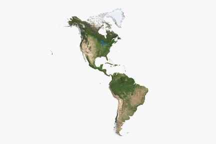


South America Topography: Natural Color Elevation Map
By TurboSquidUnlimited downloads from $16.50/month
- Unlimited stock downloads
- 26+ million premium assets
- Lifetime commercial license
- Easy cancelation
Already have an account? Sign in
Attributes
- File Types
- JPG, FBX, TGA, MTL, OBJ, PNG
- File Size
- 144 MB
- Textures Included
- Yes
- Rigged
- No
- Animated
- No
- Polycount
- 12.4K polygons
- Commercial License
- Further Information
Description
A geographic rendering of South America showcases the continent's diverse topography. Dense green forests dominate the northern regions, while the Andes Mountains stretch along the western coast, exhibiting rocky textures and snow-capped peaks. The eastern side gradually transitions into plains and plateaus with varying earth tones. Small island formations are visible off the southern tip. The land exhibits varied height and detailed relief.